

Happy Paarl Founders Month!
Before Paarl was Paarl, this valley was home to Khoikhoi communities, who had lived, travelled and grazed their livestock across the Berg River valley and surrounding mountains for generations.
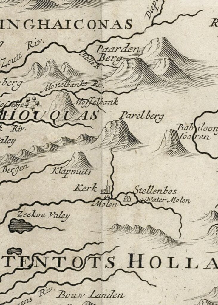
Then, in 1657, Abraham Gabbema travelled into the interior on behalf of the Dutch East India Company. He reached the Berg River and recorded the great granite mountain above the valley, naming it “Diamandt en Peerlberg” — Diamond and Pearl Mountain.
It would be another 30 years before European settlement began to take root here.
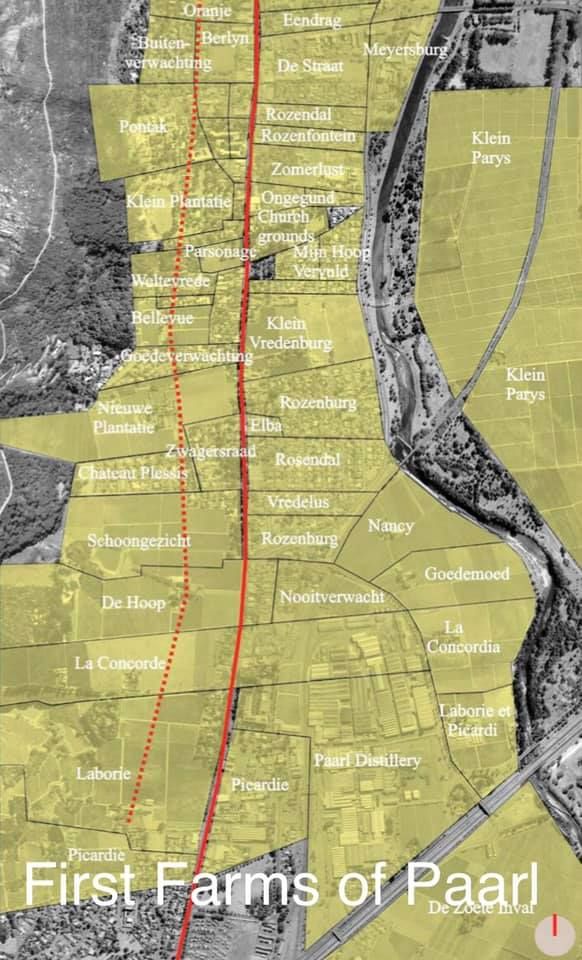
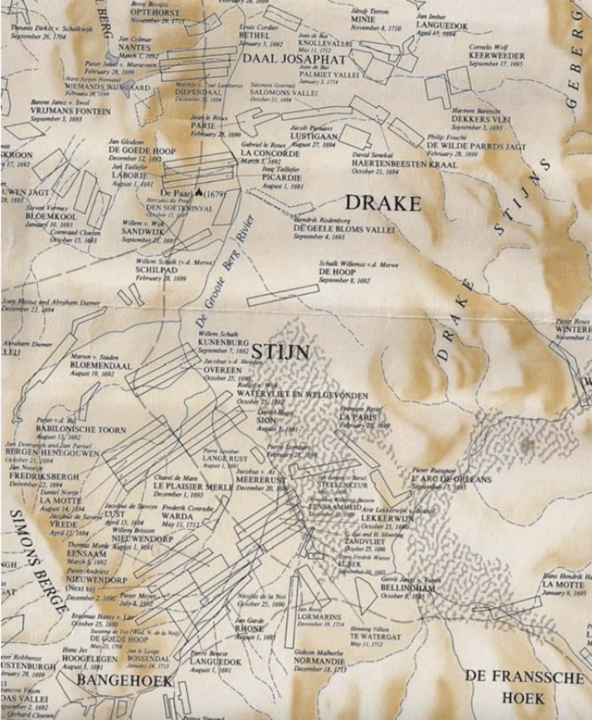
In 1687, Governor Simon van der Stel allocated land in Paarl to 23 free-burgher families. The first formal grants followed between 1689-1691, establishing farms whose names are still familiar to us today — Picardie, Laborie, La Concorde, Goede Hoop, Nantes and Bethel, Landskroon, Fairview, Diamant, Rhebokskloof and Non Pareil, Roggeland, Kleinbosch, Olyfboom, and Dekkersvlei.
But this wasn’t simply the peaceful creation of farms.
As European settlement expanded, it increasingly occupied land used by the Khoikhoi for grazing and movement. Relationships that had initially included trade in cattle became increasingly characterised by competition, livestock raiding and conflict.
Then came another important chapter.
In 1688, French Huguenot refugees began arriving at the Cape. Many were settled in the Drakenstein area, where they became part of the growing farming community. Among them were families whose names would become deeply woven into the history of Paarl and the Cape winelands.
And the settlement was already beginning to look like a town.
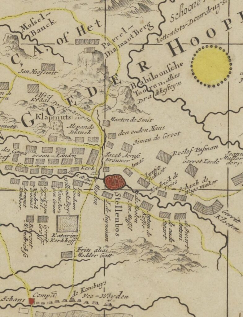
A water mill, in Mill Street, was operating in the area by around 1700, helping to establish an important early focal point for the developing settlement. The later town grew organically around the farms, church, mill, roads and river rather than being formally laid out from the beginning.
Many of the names associated with this early period are still familiar to us today — Taillefert, du Toit, Vivier, Cordier, Cloudon, Le Roux, Fouche, van Staden, Malherbe, van Vuuren, De Villiers and many more.
Paarl was taking shape.
Farms had been established.
Families had arrived.
French Huguenots had joined the community.
Vines and wheat were being cultivated.
A mill was operating.
And a settlement was emerging beneath Paarl Mountain.
At the end of the 17th century, Drakenstein was under cultivation. The population was relatively small, only about 450 people. The people of Paarl were a mixture of indigenous Khoikhoi communities, Dutch settlers, French Huguenot refugees, VOC employees and enslaved people brought to the Cape from other parts of the world.
This was the beginning of Paarl.
Images: The 1600s has very little photography and images of how Paarl looked then – however we could find some late 1600, early 1700 maps and images created by the Dutch.
#historyofpaarl
Sources: Drakenstein Heritage Survey, Drakenstein Heemkring
Note: All research for this series comes from various sources, historical sites and records. I’m not a historian, so I may get some facts or dates wrong. We have many knowledgeable historians and history enthusiasts in our community, so if I get something wrong, please correct me!